This turned out to be a bit more of an adventure than I wanted. Laurent and I decided to take the day off and go for a hike. She picked Signal Mountain Wilderness (13350 acres) and the adjoining Woolsey Mountain Wilderness (64000 acres) areas. The two wilderness areas are separated only by a jeep trail. As far as I can tell, there are no trails or roads in the Signal Mountain area, and only a single trail in the Woolsey area (that trail, I think, goes to the peak of Woolsey). That’s about 77000 acres of nothin’ (but really pretty nothin’).
This trip took a lot of planning up front. I had to plot the drive in on topo maps, figuring out the coordinates of each turn that I needed to take. This is not an easy place to reach. Milage wise, it is not that far from my home, but time wise it was a 3.5 hour drive, one way. This was a serious off road drive (at least, as far as my abilities and rig are concerned). There are a few very steep climbs (approaching 30 degrees, which is a lot) requiring careful tire placement. Lots and lots of very rough roads that make for very slow going.

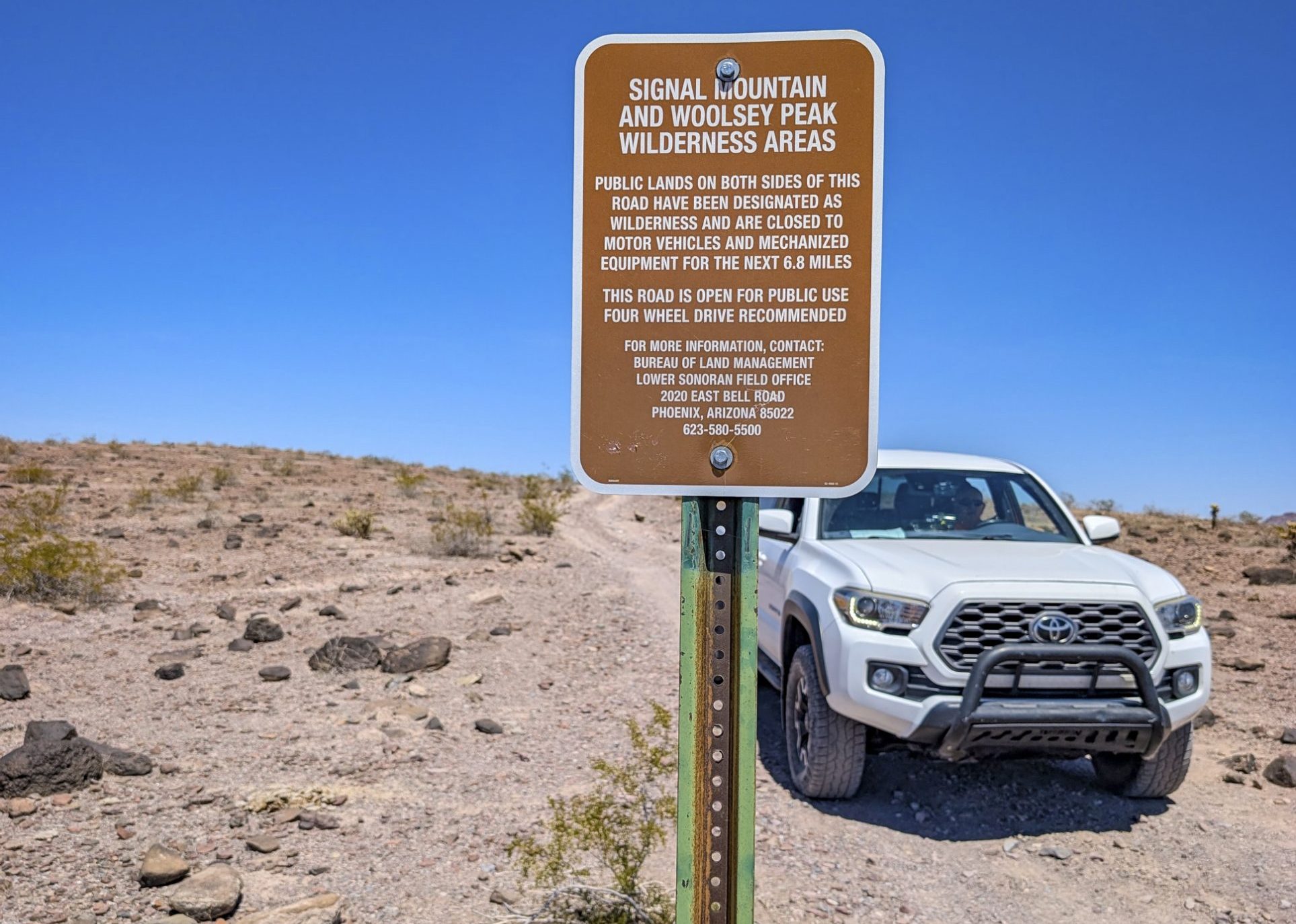
After 3.5 hours, we made it! This was our parking spot. I choose this place (before we came here, on the topo map) because it is right next to a wash that we could follow up into the mountains. Except we didn’t (follow the wash). That was Laurent’s fault. She wanted to climb all the things. Do you see that jeep trail? The side where my truck is parked in Signal Mountain Wilderness Area, the other side is Woolsey Mountain Wilderness area. See that really big mountain off in the distance (on the right)? That’s Woolsey.

Much of the terrain looks like this.

OK. This is the BEST map and compass bag EVER. My daughter Geneva made this for me, and it is PERFECT.

My daughter, the climber of all the things, and the causer of my troubles this trip.

Dead cactus. I took this because it seemed artsy.

We climbed up here. It made me tired.

More pretty.

A great picture of Mount Woolsey.

Ugh. Too much climbing. She made me come up here.

Along the way…

Also along the way…

These were some cool rock formations. This sort of stuff is why I come out here.

Hard to see it in this picture, but these are tanks. They will fill with water when it rains.

Lunch time. Yummy dehydrated backpacking food.

It is always important to take a picture of the sign, to prove to doubters that we made it this far.

The sign right across the road (if you can call it that).

After we made it out of that mess, we decided to swing by the old Gillespie dam. This is a failed dam (there is a big breach) out in the middle of nowhere. You can see part of the dam in the background.

This is the cool old bridge right next to the dam.

I do look handsome.
![]()


Laurent
9 May 2026That was a fun hike! We should climb more things (somewhere with less driving)