This weekend, I decided to go on a backpacking adventure. I’ve always wanted to try to get to Hell Canyon, located in Hell’s Canyon Wilderness Area. No typos there. The name of the canyon is singular, the name of the wilderness area is plural. I have to assume the government is responsible for that.
How hard could that be? Turns out, I never made it to Hell Canyon. It was too far. I got a late start, my pack was heavy (47 pounds), it was hot, and it was all off trail (and that’s always slower). I’m sure I could come up with more excuses for my failure… Truth is, I didn’t even get close. Here’s a picture of my topo map:
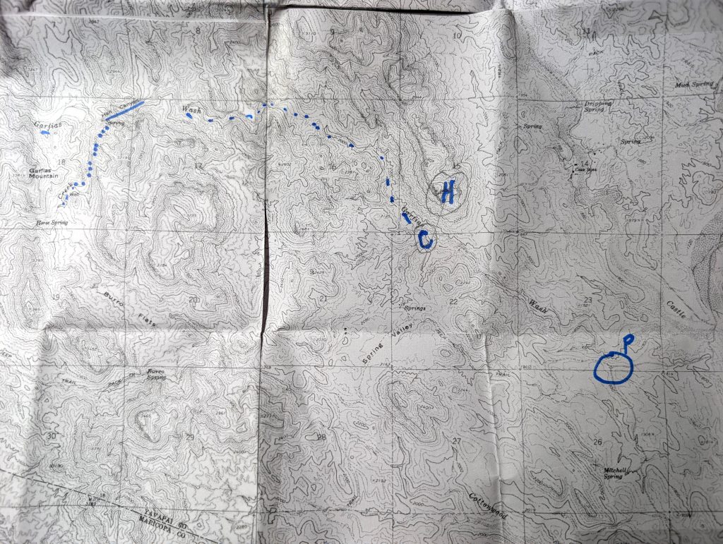
See that blue P? That’s where I parked my Tacoma (and where my adventure began). The blue H was my handrail. A handrail is a topographical feature (in this case, a mountain) that is easy to see, preferably from a good distance. As long as I can see my handrail, I know where I am. I navigate by map and compass, not GPS (I know, I know, I work for Garmin). If I can see my handrail, I can shoot a bearing to it, then plot that bearing on my map, and I know where I am. See the blue C? That’s where I camped for the night. That’s about as far as I made it. That’s it. Follow the blue dotted line to where Hell Canyon is underlined. I had a ways to go to get there!
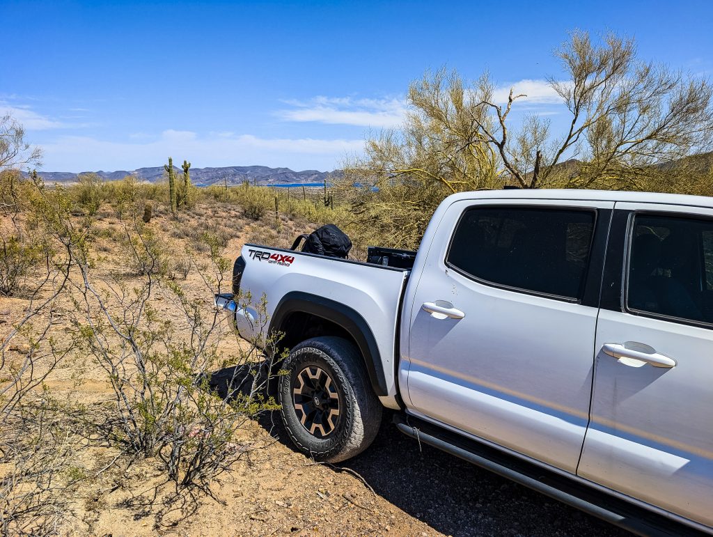
Never mind that. I had a lot of fun. Here’s where I parked. That’s Lake Pleasant in the background:
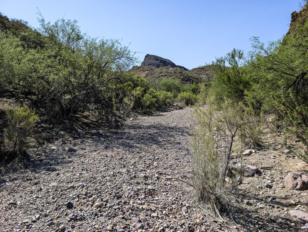
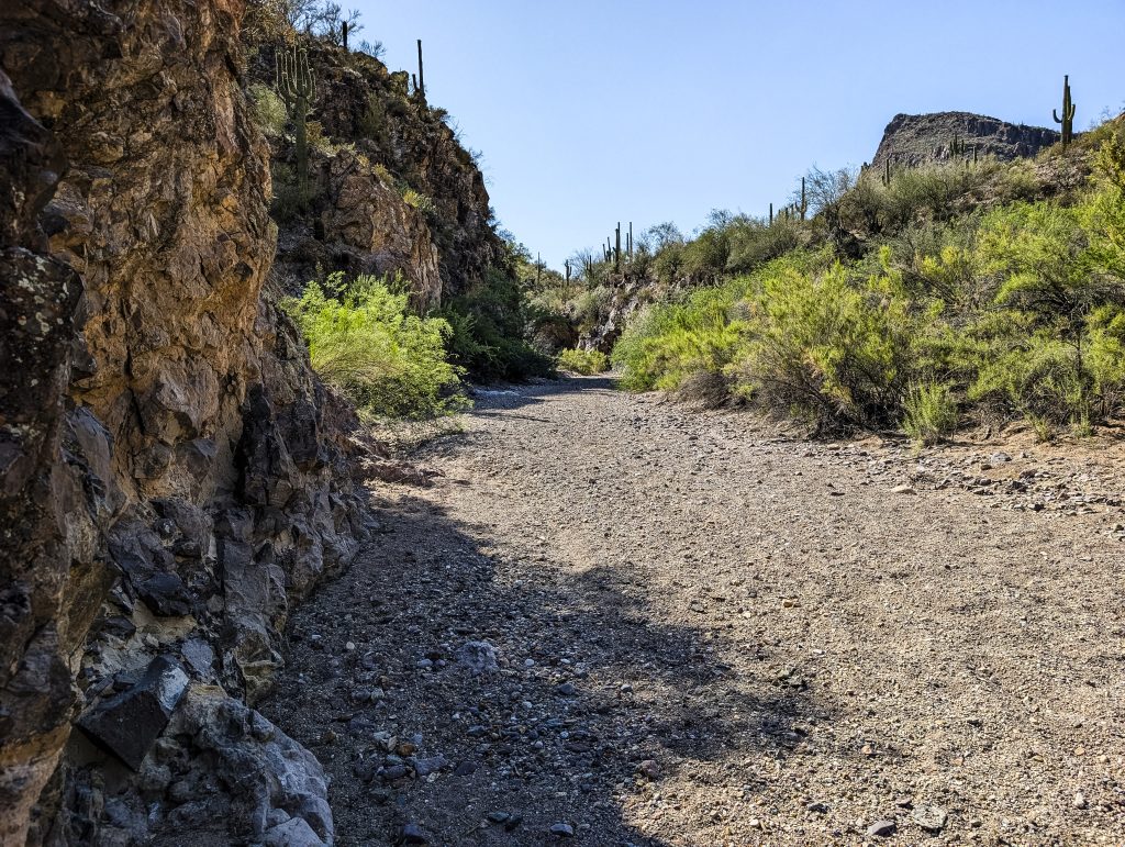
To get to Hell Canyon, you just follow Garfias Wash. Well, that’s a way to get there, I suppose. There are no trails that get you anywhere near. The problem with following Garfias Wash is that you end up walking in a wash. Those exhaust you. If you aren’t walking in loose sand, you are walking over good sized rocks (a rough surface). Like this (that mountain is my handrail):
Or this (pretty, no?). Handrail is on the right:
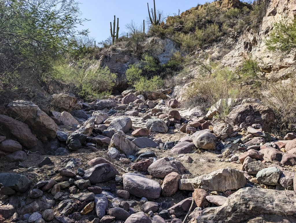
Sometimes, it gets bad. Like this:
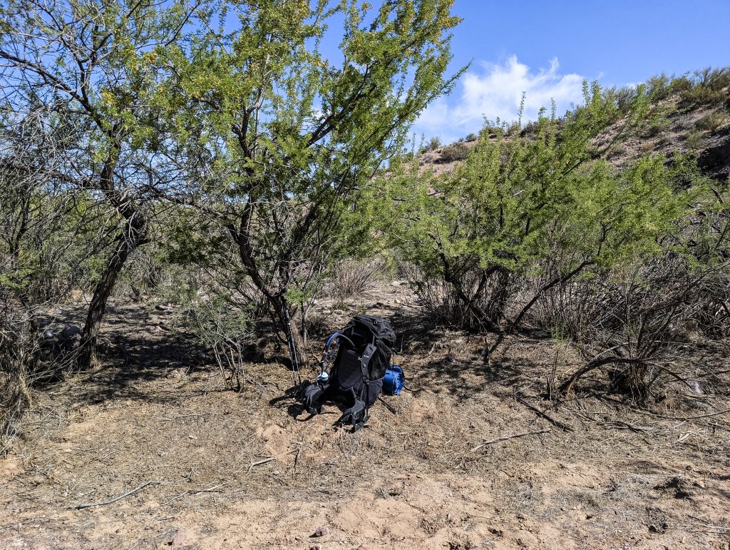
Pretty soon, I needed to rest. Here’s a good spot:
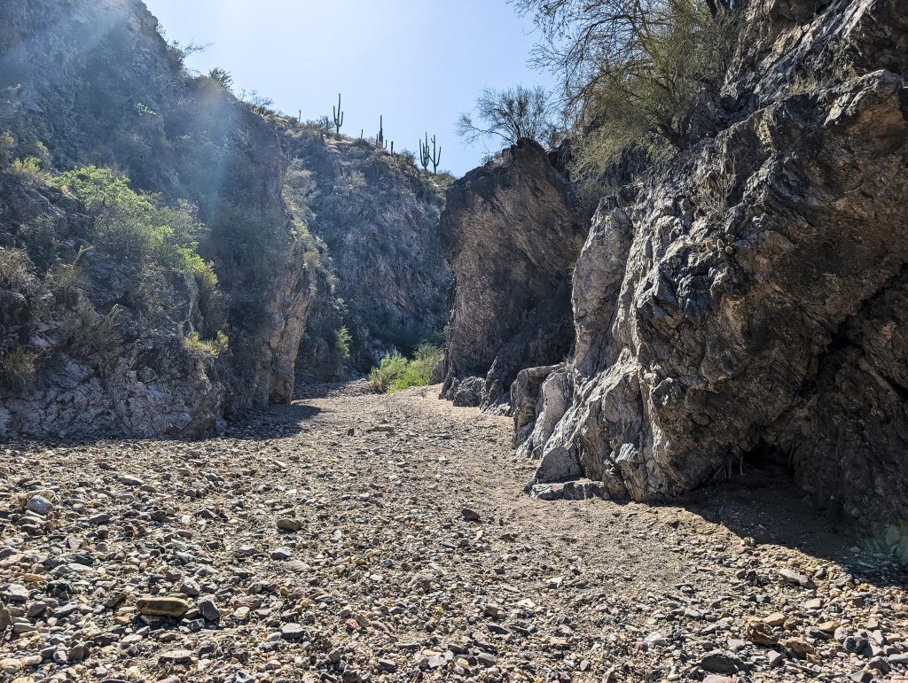
Even if I never got to Hell Canyon, there’s still a lot of pretty out here, like this:
This is called a Scree Slope. Never, ever, try to climb a scree slope. It won’t end well for you:
Climbing through this (with my heavy pack) made me tired:
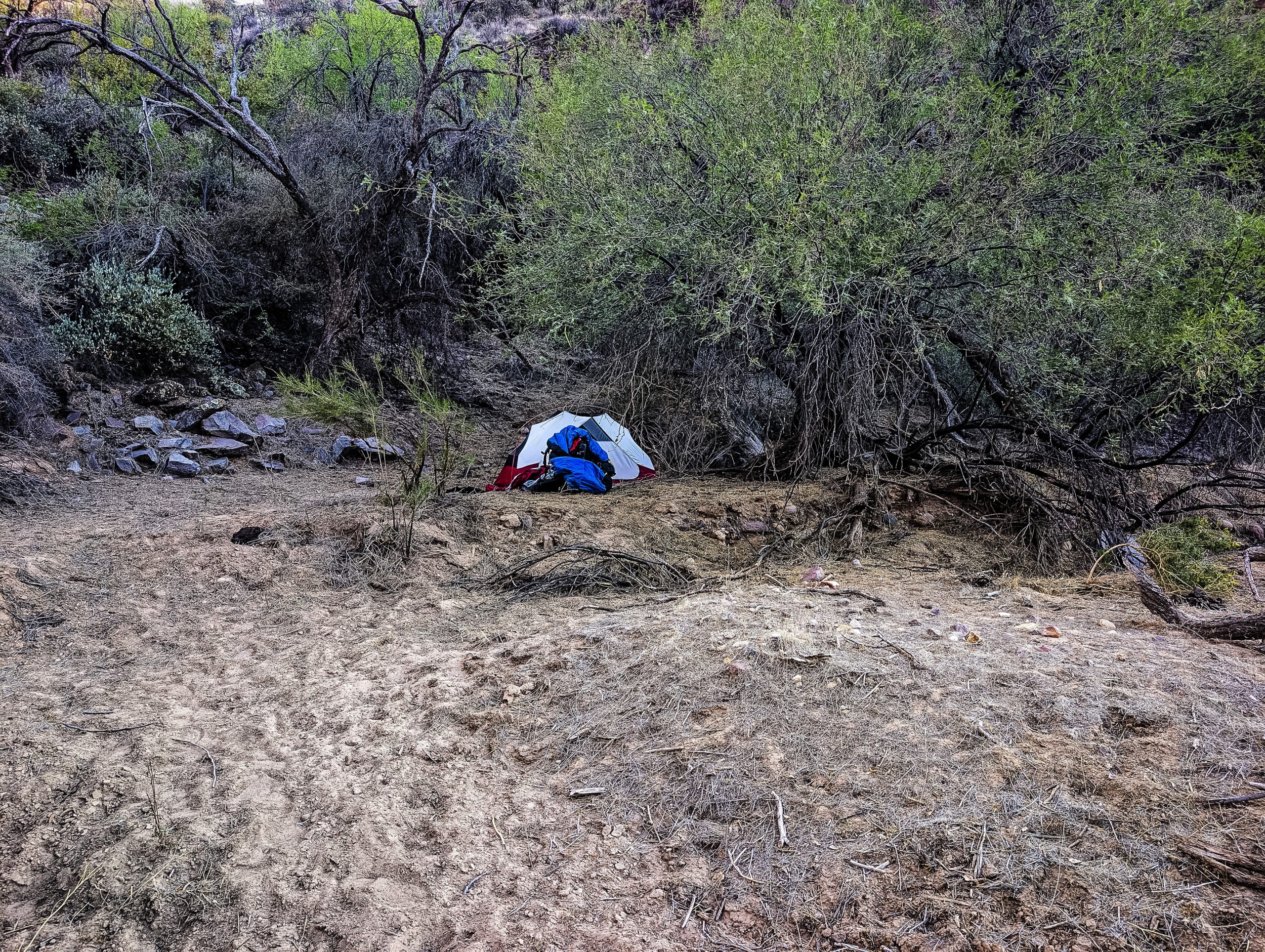
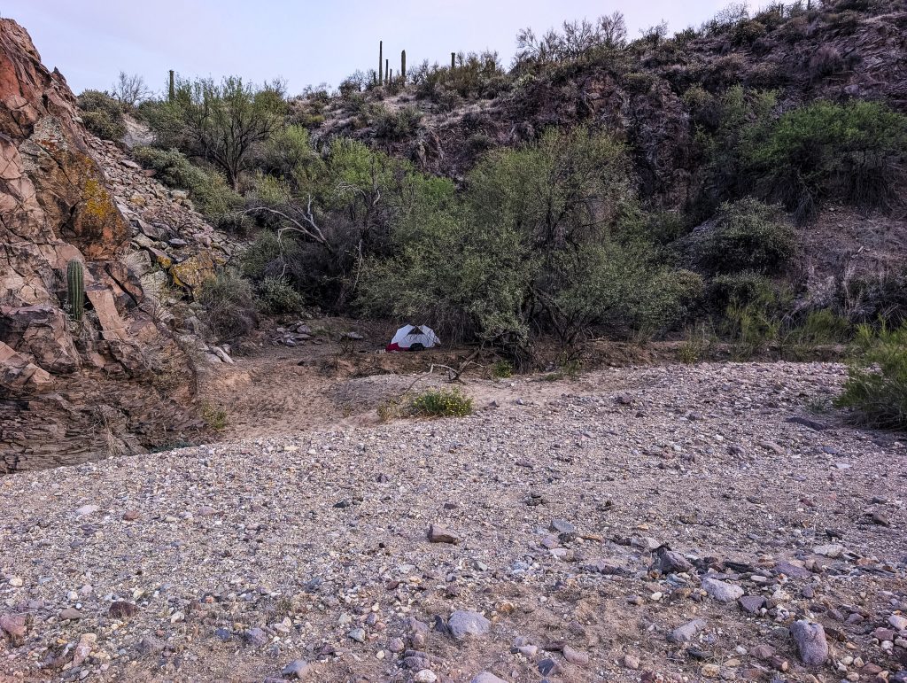
This has to be one of the sweetest camping sites I have ever found. The ground was soft, it was sheltered, has shade, and really pretty. I was happy to be here. The night was filled with sounds that I enjoyed and even helped me sleep. Birds were making noises all night long, hummingbirds were buzzing around, and in the night, little beetles dropped out of the tree, onto my tent, and made scritching noises. Happiness!
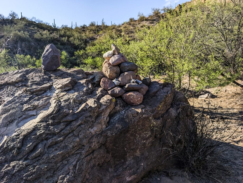
After I made camp, I walked perhaps a half mile further in, and found this. Somebody made a good sized cairn out here, in the middle of nowhere, signifying nothing. Well, OK, it very likely is the end of Spring Valley Trail. That trail does not follow the wash, it comes in from the north and ends right about here (I like the bones, nice touch).
The problem with going to bed around 7pm is that you wake up pretty early (even if you are tired). I woke up slightly before 4am (it was still dark)… Using a flashlight, I managed to break camp, and had a yummy breakfast (dehydrated backpacker food – breakfast skillet it was called – eggs, bacon, taters). I got back in half the time it took me to get here, for two reasons: my pack was a lot lighter (I drank a lot of water), and it was much cooler.
![]()


Pingback: To Hell (Canyon) And Back – Adopted Joy